Small, Medium and Large Scale Mapping
Small, Medium and Large Scale Mapping
Description
Once you have decided the objects to be represented, you have to choose the map scale. What is a termmap scale ? Scale is the amount of reduction that takes place in going from real world dimensions to the new mapped area on the map plane. Technically, the scale of a map is defined as the ratio of distance measured upon it to the actual distances, which they represent on the ground (ICA 1973). In a general way, this numerator will always be a round number (and not 1:25 350). For example, if a straight line on the ground of length 2.5 km is shown on a map by a line of length 2.5 cm, the scale of the map may be calculated from:
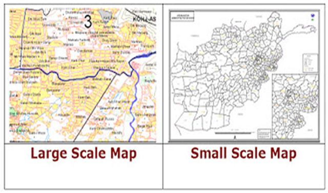
Three terms are frequently used to classify maps according to scale. The scale values attributed to each class is the following: Large-scale maps show small portions of the earth surface; detailed information may therefore be shown. Small-scale maps show large areas, so only limited detail can be carried on the map.
•Large scale maps : Scale larger than 1:5.000
•Medium scale maps: 1:25.000
•Small scale maps: Scale less than 1:50.000
Documents
• Pleiades Satellite Imagery• Spot 6-7 Satellite Imagery
• Spot 5 Satellite Imagery
• KazEOSat-1
• SPOTMaps
• TerraSAR-X Radar
• GEO Elevation Services
• WorldDEM
• Spexer_500_1000
For sales and marketing information please contact : [email protected]